"I would recommend the service (and product). [POSSE PLS] is much more user friendly than our previous system."
"The relationship that Computronix establishes with their customers is a true partnership. They want to see the project succeed and they go more than the extra mile to work with us to make sure success happens."
"I would like to add that the CX Project Team always delivers their product on time and meets project deadlines. They have also gone out of their way to listen and/or fix functionality that may not have met our original business needs."
POSSE GIS
Leveraging the latest version of ESRI ArcGIS®, POSSE GIS utilizes ESRI’s rich library of basemaps, providing a fully responsive, modern mapping experience out-of-the-box, as well as the capability to generate custom maps—enabling you to achieve the greatest benefits from your existing GIS investment. Seamlessly supporting integration with both industry standard map server applications and custom map viewers, POSSE GIS also includes an integrated browser-based map viewer for interactive searching, filtering, layering and sharing of your GIS data.
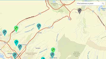
Comprehensive ability to locate, identify and drill into POSSE data from a map selection.
Work with point, line and area map objects with real-time access to spatial information processing.
Visually relate GIS objects on a map (such as permit application to a flood zone).
Features
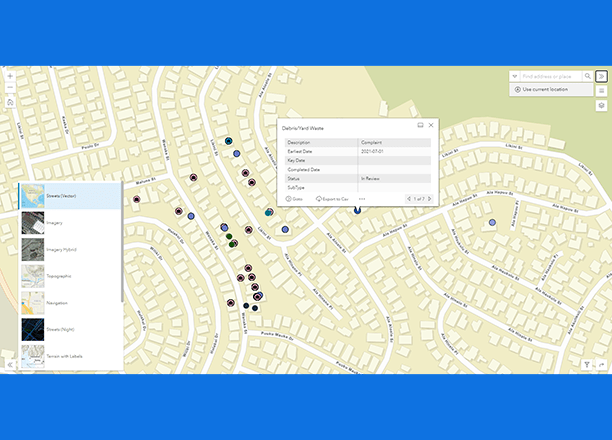
POSSE Data on a Map
POSSE PLS and POSSE ABC system user screens contain a one-click “Locate” button to quickly display an activity type or group of activities (e.g., permits, inspections, licenses, etc.) on a map for contextual geospatial referencing and informed decision-making.
You can also initiate a “Show me the related business information” search to retrieve in progress and historical data.
Create Reports or Searches
POSSE provides the ability to initiate a search based on a geographic selection on a map.
For example, to select all permit or license activity within a specified geographic boundary. POSSE also allows geographic buffers from a defined parcel (e.g., all parcels within 1,000 feet) and then automatically generate notification letters for all parcel owners in the selected buffer zone.
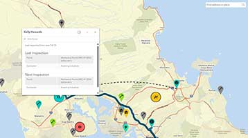
Initiate Work From a Map
When you use POSSE GIS with our POSSE PLS Permitting & Inspections Module and/or the POSSE PLS Code Enforcement Module, you can initiate a permit application or a complaint workflow directly from a map selection.
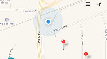
From the POSSE Citizen portal, your citizens can drop an identifying pin on a map to locate an associated complaint. Map images can be pasted into management reports, advertisements, or other printed and electronic documents.
"I have worked extensively with Computronix over the last 10 years. I found Computronix to be enthusiastic, innovative, patient and always professional when they were working with our team at the City."
Pat Drake
Program Manager, Application Development Partnership